A Result Paper on Deforestation Monitoring and Cause Detection in India Using Satellite Imagery
Keywords:
Abstract
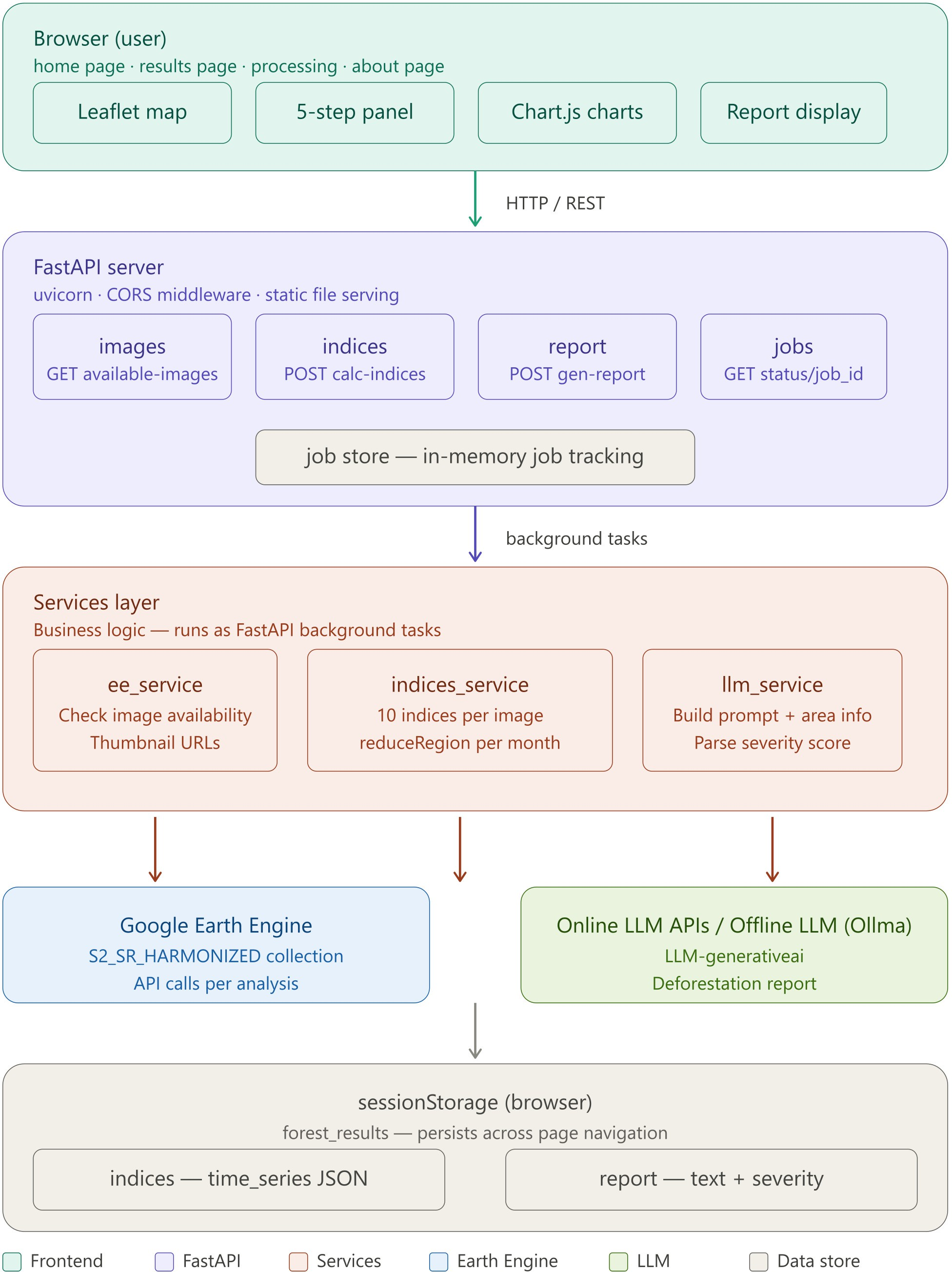
Forests in India are disappearing rapidly. This paper presents an automated system that monitors deforestation using satellite imagery and AI. Users enter any location’s coordinates. The system pulls images from Sentinel-2 via Google Earth Engine and analyzes changes over multiple years. Ten vegetation indices (NDVI, NDWI, EVI, MSAVI2, NDMI, NBR, BSI, NDBI, SAVI,
GNDVI) are calculated to track plant health, soil, and water conditions. A large language model interprets the data and identifies likely causes of forest loss. A web interface built with FastAPI makes the tool accessible to non-experts. Testing on Anamalai Hills, Kerala successfully detected a severe drought event in September 2025 and tracked the forest’s rapid recovery. The system shows that combining satellite data with AI enables scalable, automated forest monitoring.