
Integration of Satellite Remote Sensing and Machine Learning for Pond Water Quality Prediction in Eluru
DOI:
https://doi.org/10.65521/ijmer.v14i2.1703Keywords:
Abstract
Aquaculture is essential for addressing global food security, but its sustainable expansion faces significant hurdles—particularly in monitoring water quality. In key aquaculture hubs like Eluru, India, the well-being and output of fishponds hinge on critical factors like dissolved oxygen (DO), pH levels, and ammonia concentrations. Conventional monitoring techniques, which involve labor-intensive manual sampling, are costly, inefficient, and difficult to scale across vast pond networks. To overcome these limitations, this study introduces an innovative solution: a fusion of satellite remote sensing and machine learning designed to deliver scalable, affordable, and near-instantaneous water quality assessments.
At the core of this approach is Sentinel-2 multispectral imagery, offering detailed optical data spanning visible, near-infrared (NIR), and shortwave infrared (SWIR) wavelengths. While DO, ammonia, and pH cannot be directly measured by satellites, they can be estimated using spectral indicators such as reflectance values (B2, B3, B4, B8, B11, B12) and water-vegetation indices like NDVI, NDWI, MNDWI, and NDCI. The methodology follows a two-phase process: (i) reconstructing missing satellite data caused by cloud cover or gaps using interpolation and regression techniques to maintain dataset continuity; and (ii) training a Random Forest regression model on historical in-situ measurements alongside satellite-derived metrics to predict DO, ammonia, and pH concurrently.
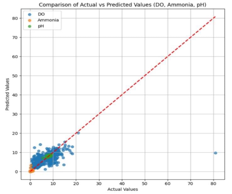
Findings reveal that this combined method effectively compensates for incomplete satellite observations while yielding precise estimates of vital water quality metrics. By facilitating large-scale, routine monitoring of thousands of ponds, the system drastically reduces reliance on manual sampling. This advancement holds promise for bolstering aquaculture welfare programs, enhancing fish health and productivity, and promoting the long-term viability of inland aquaculture operations.
Downloads
Published
How to Cite
Issue
Section
License

This work is licensed under a Creative Commons Attribution-NoDerivatives 4.0 International License.